Antique Prints, Maps, & Books of Natural History, Botanicals, & More
Trillium Antique Prints & Rare Books
צור קשר עם בית המכירות
29.3.25
115 Hampsted Lane Franklin, TN 37069, ארצות הברית
תנאי המכירה
הדגמת מכירה
|
פריט 80431:
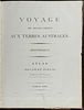
Freycinet's Voyage.. Terres Australes - Atlas Volume with 14 Maps
עוד...
|
|


|
נמכר ב: $6,450
מחיר כולל עמלה:
$
6,901.50
מחיר פתיחה:
$
4,500
הערכה :
$10,000 - $15,000
עמלת בית המכירות: 7%
למידע נוסף
|
Freycinet's Voyage.. Terres Australes - Atlas Volume with 14 Maps
This detailed map is from Louis de Freycinet's Voyage de Decouvertes aux Terres Australes. Historique [Atlas. Deuxième Partie]. The work was published in Paris in 1811 by Imprimerie Imperiale.
This work was noted for publishing the first detailed and complete map of Australia. Freycinet's atlas was essential to the history of European exploration of Australia. Hill notes Freycinet "entirely ignored the discoveries of British explorers, and depicted the whole of the south coast, from what is now Melbourne to the border of Western Australia, as the 'Terre Napoleon.'"
This engraving was completed after the expedition of Nicholas Baudin. It was one of the most important early explorations of Australia. The expedition was sent out by the French government in 1800 with orders to complete the survey of the Australian coast. Commanded by Baudin, the expedition left France in 1800 and sailed via Mauritius to the Australian coast in the region of Cape Leeuwin, arriving in May 1801. Louis de Freycinet (1779-1841) served as the cartographer and surveyor for the voyage.
The vessels, Geographe and Naturaliste, sailed north from Cape Leeuwin, surveying the coast and making observations on the natural history and inhabitants, until they crossed to Timor. After three months the two ships set out for Tasmania, continued making detailed surveys, and went on to Sydney. The group then undertook a complete survey of the southern coast and an examination of the northern coast before returning to Mauritius. It was a celebrated voyage for France.
Paper Size: ~ 10" by 13 1/4"
Paper Type or Special Features: Volume with 14 Maps
The work is in very good to excellent condition overall. There is some minor rubbing to covers. The joints are a little weak and splitting slightly. There are a couple neatly repaired closed tears to folding maps. There is some minor foxing throughout and a light, marginal damp stain to the last map. There may be a few minor marks or imperfections to be expected with age. Please review the image carefully for condition and contact us with any questions.
